Turn real world places into downloadable Minecraft Java Edition worlds.
Cities and real places
Minecraft city generator for real streets, landmarks, and neighborhoods
A good MaptoCraft city world starts with a good selection, not a giant search result. This guide explains
how to choose city blocks, landmarks, campuses, parks, and neighborhoods that convert well, which settings
to use first, and when to split a large real-world place into smaller Minecraft worlds.
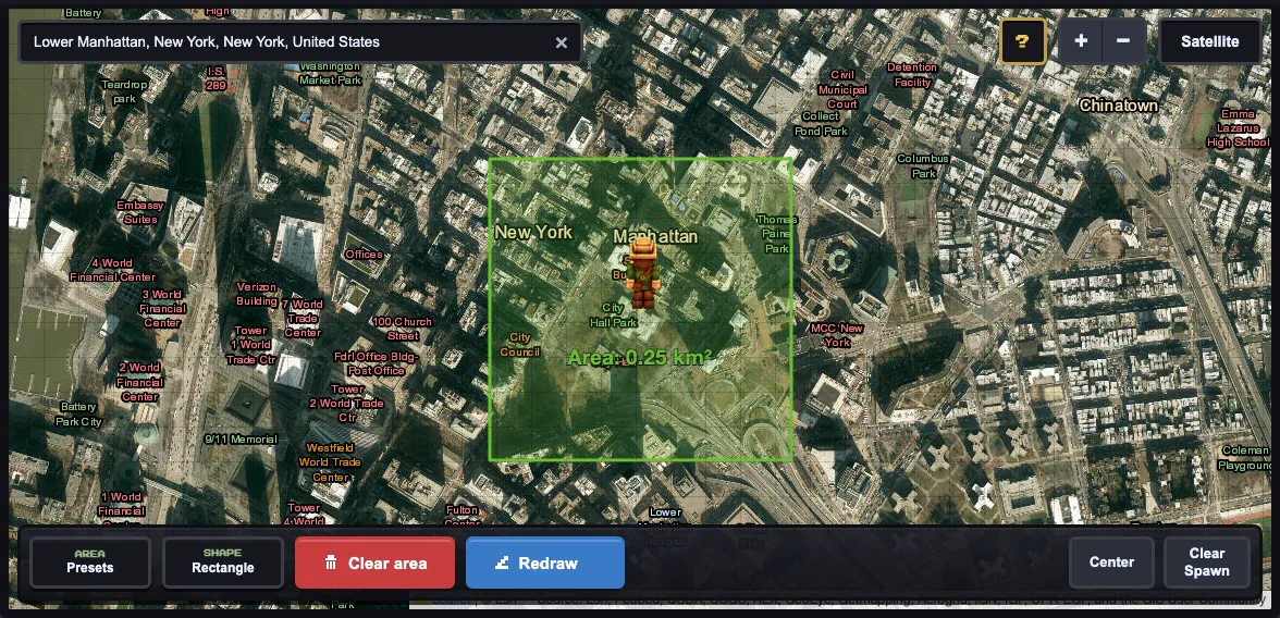
The map selection used for the generated city preview. Lower Manhattan is a strong first city example
because roads, building footprints, parks, and water edges are concentrated inside a compact area.
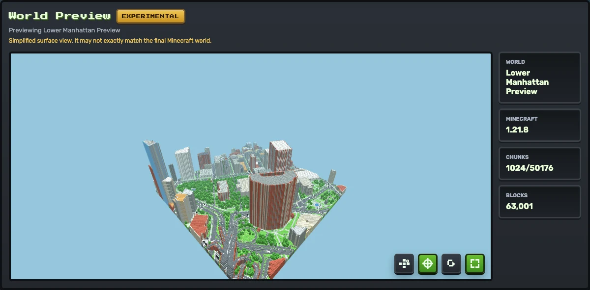
Generated preview from that Lower Manhattan city test. Use this view to check whether the street grid,
building massing, parks, and spawn context are worth downloading into Minecraft.
Choose the right kind of city selection
City generation works best when the selection contains a clear pattern: a street grid, district center,
recognizable landmark, campus quadrangle, waterfront, plaza, or park. A whole city may sound appealing,
but it often produces slower generation, more memory pressure, and a world that is harder to inspect.
Start with one useful piece of the place. For a downtown, choose several blocks. For a landmark, include
the paths, nearby roads, and open spaces around it. For a campus, select the main quad or core buildings
first. For a neighborhood, choose the densest block rather than the entire suburb.
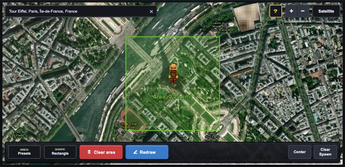
Landmark selections should include context. A 500 m area around the Eiffel Tower captures surrounding
paths, parks, roads, and buildings that help the place feel recognizable.
City and landmark settings that usually work first
Dense city block
Tiny 500 m, terrain off, scale 1, roofs on, preview before download.
Landmark or park
Tiny 500 m or Small 1 km, terrain off first, include surrounding paths and roads.
Campus
Tiny or Small preset, terrain off unless slopes matter, spawn near the main quad or entrance.
Hilly city
Run a flat 500 m test first. If the layout is good, retry with terrain enabled and smoothing 1.
When to split a city into multiple worlds
If you want a large city, treat it as a series of focused generations. Generate the financial district,
park, campus, waterfront, or landmark zone separately. This gives you cleaner tests, makes failures
easier to diagnose, and avoids asking the browser to process a massive area in one run.
Use one 500 m test to confirm the city has useful map data.
Use separate worlds for different districts if they have different terrain or density.
Keep a note of the settings that worked for each area.
Only try larger selections after smaller ones generate and preview correctly.
Troubleshooting city results
City worlds can fail in different ways. If roads appear but buildings are sparse, the area may lack
mapped building footprints. If generation is slow, the area is probably too large or terrain is doing
extra work. If the world feels hard to recognize, include more surrounding context rather than only the
center point.
Too empty: choose a denser mapped block or inspect the OpenStreetMap data first.
Too slow: use Tiny, disable terrain, and keep scale at 1 for the next test.
Landmark unclear: include paths, roads, open spaces, and nearby buildings.
Spawn awkward: place spawn on a street, plaza, park, or open area inside the selection.
Start with a dense 500 m city block or landmark area with visible roads and building outlines. It is easier to inspect and less likely to fail than a large city selection.
Is MaptoCraft only for big cities?
No. It can also work for neighborhoods, campuses, town centers, parks, landmarks, and small districts when the source map data is detailed enough.
Should I enable terrain for a city?
For a first city test, terrain off is usually better. Turn terrain on later if hills, slopes, or coastlines are important to the place.
Why does a landmark need surrounding context?
Landmarks are easier to recognize in Minecraft when paths, roads, parks, buildings, or water around them are included in the selected area.